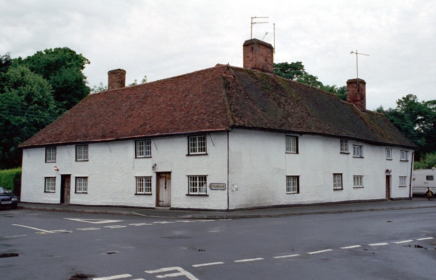
The Town House
Burnt Oak Cottages on OS Map. Range of cottages. 3 builds. Early C16 range to Flatford Road, later C16 range to Main Road with probable C17 addition to right. Later alterations.
In 1654 was purchased by the Parish overseers to house the poor.
- 42
- Grade 2
- Known as Burnt Oak Cottages on the OS Map, early C16
- 51.968738, 1.023568
Local History
The Townhouse was purchased by the Parish Overseers in 1654 to house the poor.
Details
Burnt Oak Cottages on OS Map. Range of cottages. 3 builds. Early C16 range to Flatford Road, later C16 range to Main Road with probable C17 addition to right. Later alterations. Timber-framed, rendered. Plain tile roof. Red brick stacks. 2 storeys, L-plan. Flatford Road front: 4 1st floor windows. Two C20 doors, small-paned casements. Steeply-pitched hipped roof. To Main Road: 5 1st floor windows, irregularly spaced. Range to left is jettied to rear. Steeply-pitched roof. Range to right is slightly lower with lobby-entry plan with half-glazed door and further entrance in gabled porch to gable end. Interior: Flatford Road range: chamfered beams and exposed joists. No 2 shows jowled posts, cambered tie-beam. Unmoulded crown post with mortice for missing brace to collar purlin with splayed scarf. Roof not fully inspected. In 1654 this building was bought by the Parish Overseers for housing paupers.
- 42
- Grade 2
- Known as Burnt Oak Cottages on the OS Map, early C16
- 51.968738, 1.023568
- Historic England Reference: 1033471

