
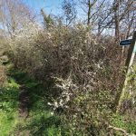
The Donkey Track is a long-established footpath which runs northwards from Gandish Road across what was originally the village "heath" or "common".
To the south-west of the track, the undulating land is divided by the Riber stream which continues across Rectory Hill and eventually down to the Stour.
The western boundary is created by the rear of The Old Rectory and properties which face Rectory Hill, The Street, and Gaston Street.
The north-eastern side of the track is distinguished by a 20-year-old woodland at the southern end leading to cultivated fields divided by hedges leading up to Heath Road/Mill Road, the main vehicular route around East Bergholt. The rear of the 1970's Richardson Road estate and the Medical Surgery complex abut the land to the north.
This section runs from the village centre at the Gaston Street junction, from The Gables* along the western side of Hadleigh Road to the junction with Hughes Road (* The Gables is a listed building which sits in the current Conservation Area).
While the eastern side of the road is not for conservation area consideration, (mainly lined with set-back 20thC and 21stC houses and the school playing field), it does contribute to the attractive natural tree cover that characterizes the road.
Together with the western side, the mature trees create a pleasing “tunnel†effect over the road at all seasons. The tree-lined frontages for historic buildings such as Gatton House and Ackworth House, which are spaced out along the road, with driveway entrances such as the one for the Gattinets business units. Generally, these historic buildings are only partly visible from the road where the vegetation predominates, with no pavement on this side.
At the top Hadleigh Road intersects with Hughes Road and Elm Road, before it continues northwards. Here there is a large open meadow in front of the historic Allens Farmstead, and features the gated drive to the Grade 2* -listed “The Lodgeâ€, which is not really visible from the road.
Old Hall over the years has been in many different forms including St Mary’s Abbey (1849-1940) and The Franciscan order of Friars Minor (1945-1973)
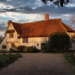
The area at the centre of the village, defined by its significant historic buildings and the early origins.
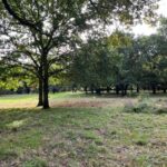
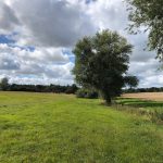
East Bergholt has a long and rich history dating back to before the Middle Ages. The village is clustered around an extensive heath that was common land supporting the local population until it was divided up amongst the existing landowners in the period of the legendary 18/19 Century Enclosures Acts. The famine that this caused led to the depopulation of the countryside with landless workers forced to seek employment in emerging industrial centres like Ipswich. The Box Iron remains an undeveloped and largely unchanged area of public heathland giving us a fascinating rearview mirror sense of what the village must have been like pre-Enclosures. Â
The Box Iron gives us a valuable insight into those pre-enclosures days. Although privately owned, it remains an area of undeveloped heath land, populated with wild meadows and huge oak trees.
As modern East Bergholt converts its open fields into rows of new houses, the Box Iron remains one of the last few open public areas in the village. areas. Sadly, East Bergholt's famed bucolic past of rural idyl, as portrayed in John Constable's wonderful landscapes, has now changed - East Bergholt having been reported as one of Babergh District's villages most lacking in available public open spaces.
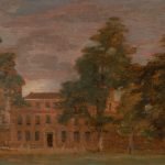
Painted from the grounds of East Bergholt House circa 1811, Beaufort Cottage stands at the edge of the old Village Green and has close links to both 'A Village Fair' and 'Flatford Mill' painted in the same year.
RADAR keys for access to disabled facilities available on request from the Co-op next door.
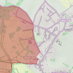
East Bergholt Village Heart encompasses an area of land bordering Gaston Street, The Street and Rectory Hill, between the two main settled parts of the village. This is a part of a designated Conservation Area and is wholly within the Dedham Vale AONB.
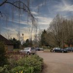
East Bergholt village car park with parking for up to 30 cars together with space for coaches
Initially titled 'Wooley Hall' this sketch shows the magnificent frontage of West Lodge as seen from Constable's family home, East Bergholt House.
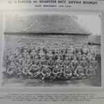
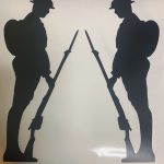
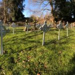
Formed in early 1915, the East Bergholt Volunteer Training Corps (VTC) was made up of volunteers who were either too old to serve in the Armed Forces, or who were excluded for other reasons, but who were still anxious to “do their bit†to protect the country.    Â
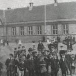
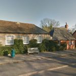
This would have been the main school for youngsters from East Bergholt and the surrounding area age 5-15 and could accommodate around 50 pupils in mixed classrooms with seperate playgrounds for boys and girls.Â
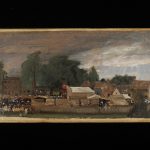
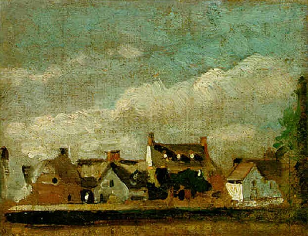
Constable painted many elevated views from the upper levels of East Bergholt House, his childhood home, including this ‘Village Fair’ painted in 1811.
Better known now as "Touchy Lane", "Procession Lane" originally a footpath connecting the top of Touchy Hill with East End.Â